Ware County
Board of Elections
& Registration
Geographical Information Systems
GIS
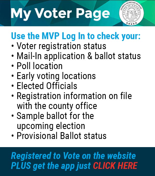
Ware County Election Information
Web map created to allow the viewing of publicly available data maintained by Ware County, GA.
The department’s GIS (Geographical Information Systems) staff maintains and distributes computer-based geographical data mapping and analysis software tools. Daily GIS operations include the creation and management of the county’s GIS database used to graphically represent data in the form of computerized maps for such entities as political boundaries, land parcels, subdivisions, street networks, and other specialized information used in the county’s general operations and planning activity. The department’s GIS staff manages and maintains the GIS-related hardware, software, data, and applications internally.
For other GIS data such as Flood maps, Parcel viewer and zoning maps please visit the Ware County website at: warecounty.com